|
Monture Creek Trail
No. 27 & Falls Creek Trail No. 16
in Powell
County
click here for
Monture Creek Trail No. 27 trailhead location on Google Maps
|
Also know as Monture Hahn Trail (27), the
Monture Creek Trail (27) is the main trail up Monture Creek,
over Hahn Pass and down to Youngs Creek where they form the
headwaters of the South Fork of the Flathead River. It's
relatively flat till it climbs over the pass. We did not
hike that far. Expect to see people and horses on this
trail since it's one of the major easy routes into the Bob
Marshall Wilderness.
For Mountain bikers, Monture Creek is one of the best intermediate
level trails with a backcountry feel and about an hour's
drive from Missoula. With a campground at the trailhead, the
Monture Creek trail should be on every Western Montana
mountain bike riders bucket list.
The first mile of Monture is on an
old logging road - perfect for beginners who desire a short,
scenic ride. The next few miles are great, intermediate
terrain with great sight lines and tread. Beware, we
did see a full grown black bear on this hike about 30 feet
from the trail. Luckily it ran off after observing us
for about 10 seconds.
Dogs: Off-leash
If you keep cruising on Monture, please keep your head up
for stock use. This area is one of the main portals for
horsemen entering the Bob Marshall Wilderness. If you
encounter a horse, or a pack string, please step off
carefully to the downside of the trail, remove your helmet
(you look like an alien to horses!) and talk quietly to
the animals as they pass. Please respect the outfitters and
their animals and do your best to keep the trail conflicts
to an absolute zero!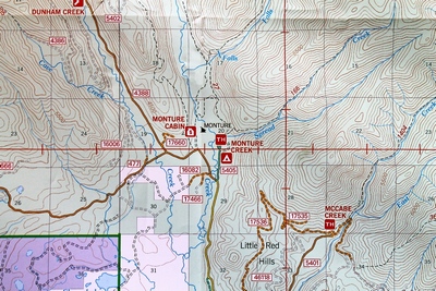 There are several loop and out-and-back options that begin from
Monture. This trail eventually runs into the Scapegoat
Wilderness, making it an out-and-back ride unless you add in
Falls Creek, Center Creek, or Spread Creek.
There are several loop and out-and-back options that begin from
Monture. This trail eventually runs into the Scapegoat
Wilderness, making it an out-and-back ride unless you add in
Falls Creek, Center Creek, or Spread Creek.
Beginning at Monture Creek Campground, take the main Monture
Trail #27, which starts off on an old logging road for 1/2 mile
before turning into a satisfying, zippy singletrack.
At 1.3 miles, the junction with Falls Creek is just across
the wooden bridge. Falls Creek is an awesome out-and-back to
Camp Pass, but be warned, prepare to walk the bike up the
hill.
Since this trail does encounter a Wilderness area, please be
respectful of the regulations that prevent cyclists from
entering the Wilderness. About 10 miles in (close to the Center
Creek junction), there is a Wilderness boundary, this is your
turn-around point unless you head up Center Creek to access
Center Ridge.
Monture, Center Creek, Center Ridge, Falls Creek and Spread
Creek are currently threatened by a proposal to expand existing
Wilderness Boundaries. If you head into this area, please sign a
visitor use card at the trailhead saying you are a mountain
biker and what route you'll be riding. Stop by the cafe and bar
in Ovando after your ride for refreshments. |
|
 |
|
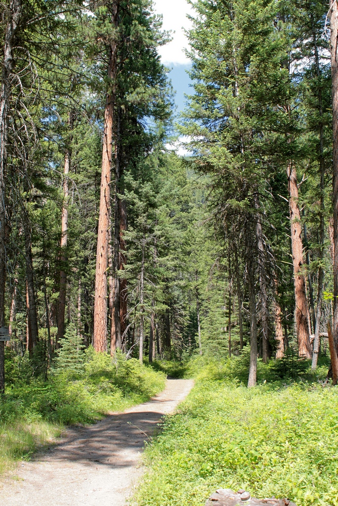
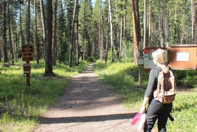
Beginning of the Monture
Creek Trail in Powell County western Montana north of Ovando |
|
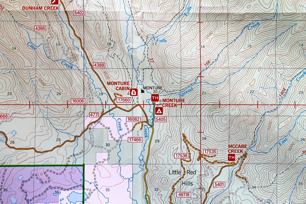
Click MAP above for a LARGER IMAGE. Pictures taken 6/27/17
all photos by Andy Christen
Click on the images to enlarge |
|
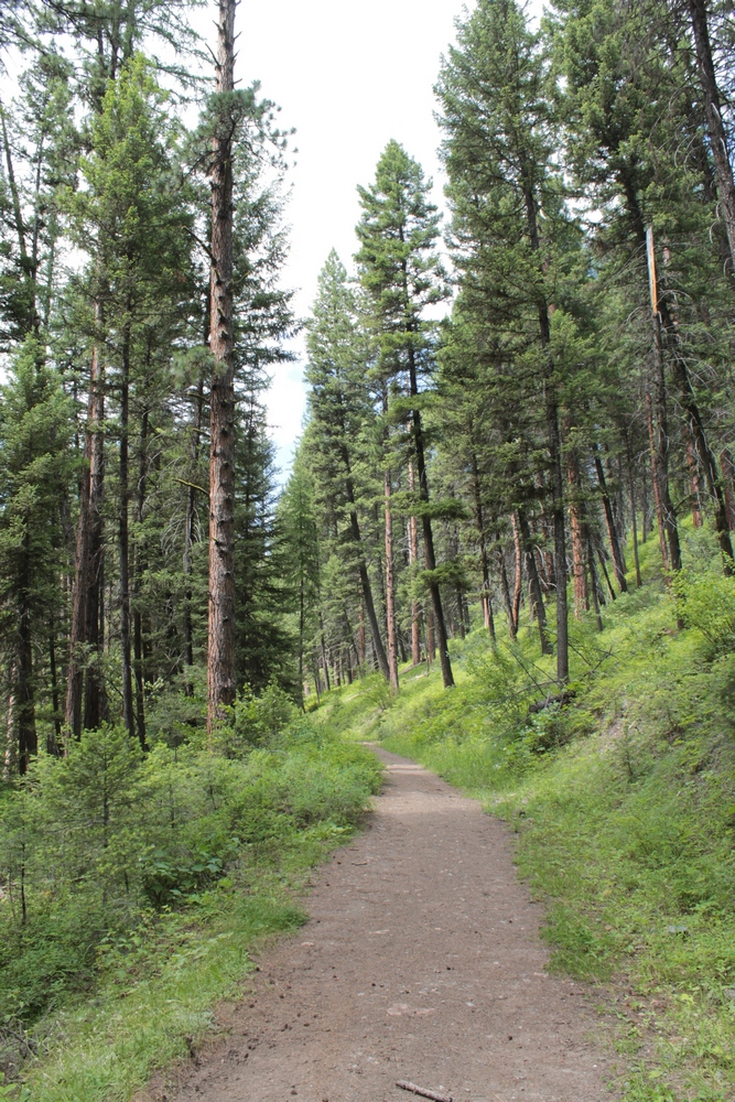
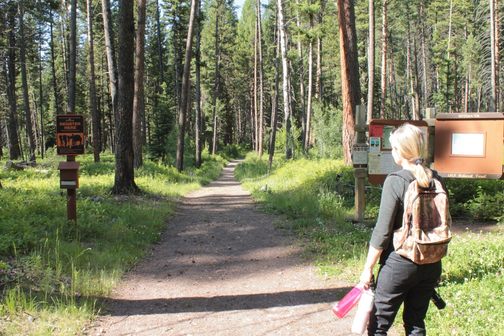
Hiking along about a half
mile into the Monture
Creek Trail in Powell County western Montana north of Ovando |
|
|
|
Local Bike Club:
MTB Missoula (Trail Advocates) |
|
 |
 |
 |
 |
|
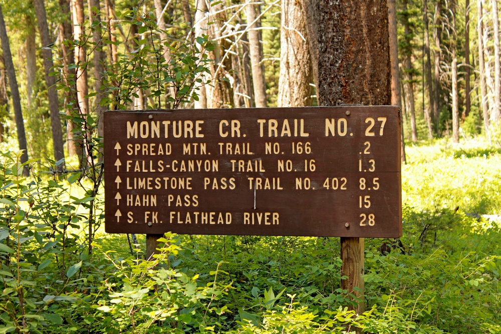
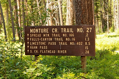
Sign indicating distances
posted at the trailhead of the Monture Creek Trail in Powell
County western Montana north of Ovando |
|
|
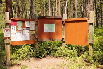
Signs posted at the
trailhead of the Monture Creek Trail No. 27 in Powell County western Montana
north of Ovando |
|
|
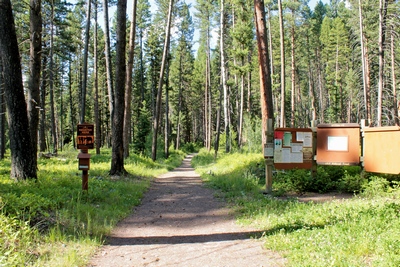
Trailhead of the Monture
Creek Trail in Powell County western Montana north of Ovando |
|
|
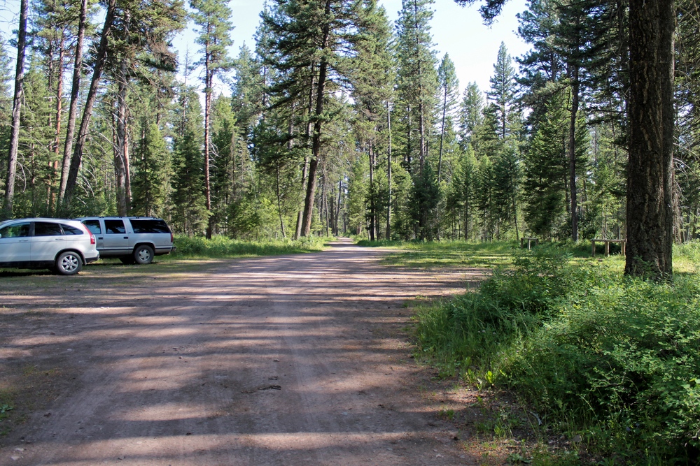
Parking lot at the Monture
Creek Trail Trailhead in Powell County western Montana north
of Ovando |
|
 |
 |
 |
 |
|
Beginning a hike on the Monture
Creek Trail in Powell County western Montana north of Ovando |
|
|
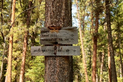
Old wood signs posted on a
tree near the beginning of the Monture Creek Trail in Powell
County western Montana north of Ovando |
|
|
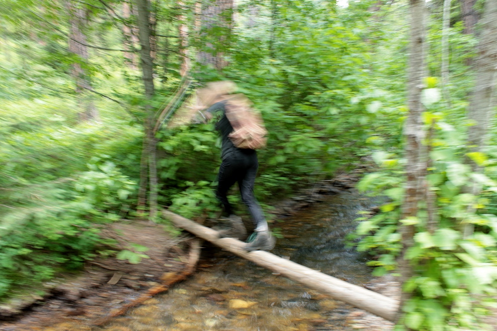
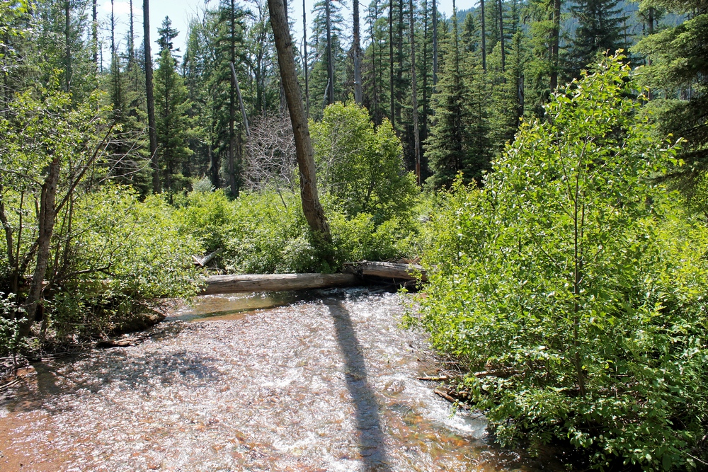
Harrowing creek crossing
(Spread Creek) on the Monture
Creek Trail in Powell County western Montana north of Ovando |
|
|
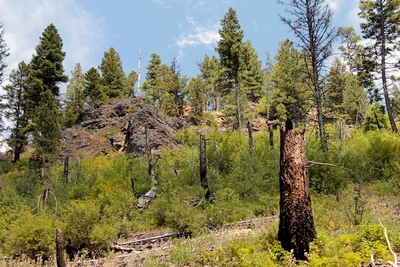
The Monture fire burned
almost 24,000 acres at the head of Monture Creek in 2000,
spilling over Hahn Pass |
|
 |
 |
 |
 |
|
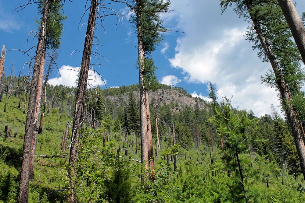
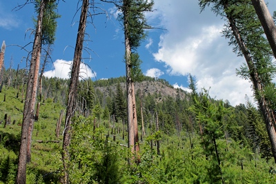
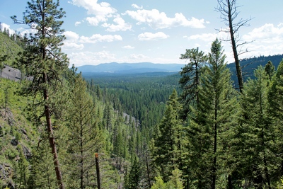
From the trail looking
northeast in the direction of Spread Mountain (which can't
be seen), the higher elevation above reaches 6500' |
|
|
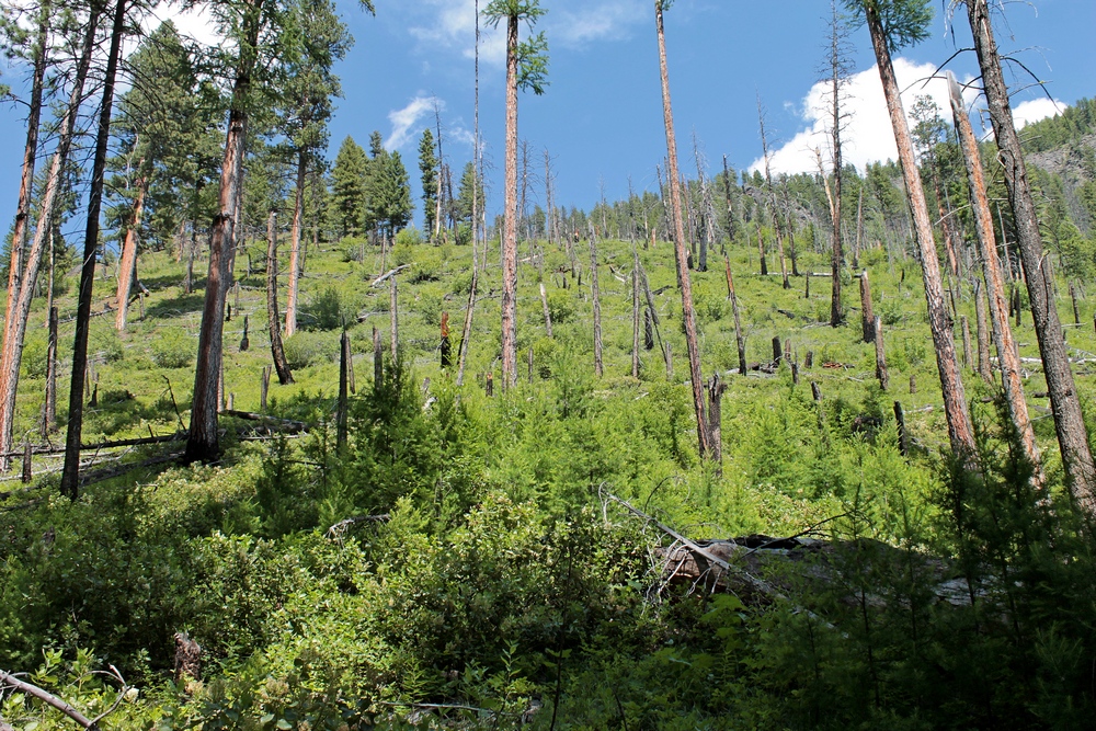
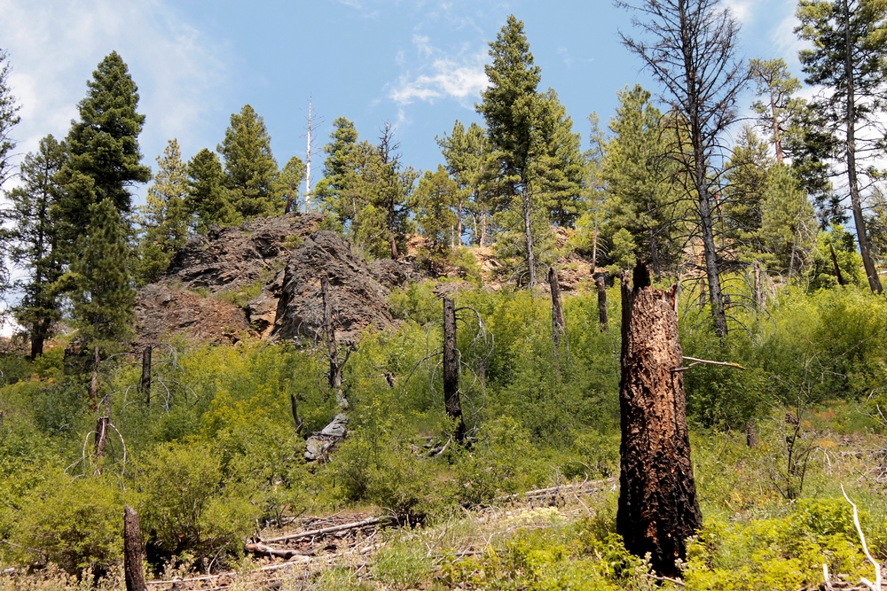
In 2000, the Monture fire
burned almost 24,000 acres at the head of Monture Creek.
This view is looking northeast from the trail about 1.25
miles into the hike. |
|
|
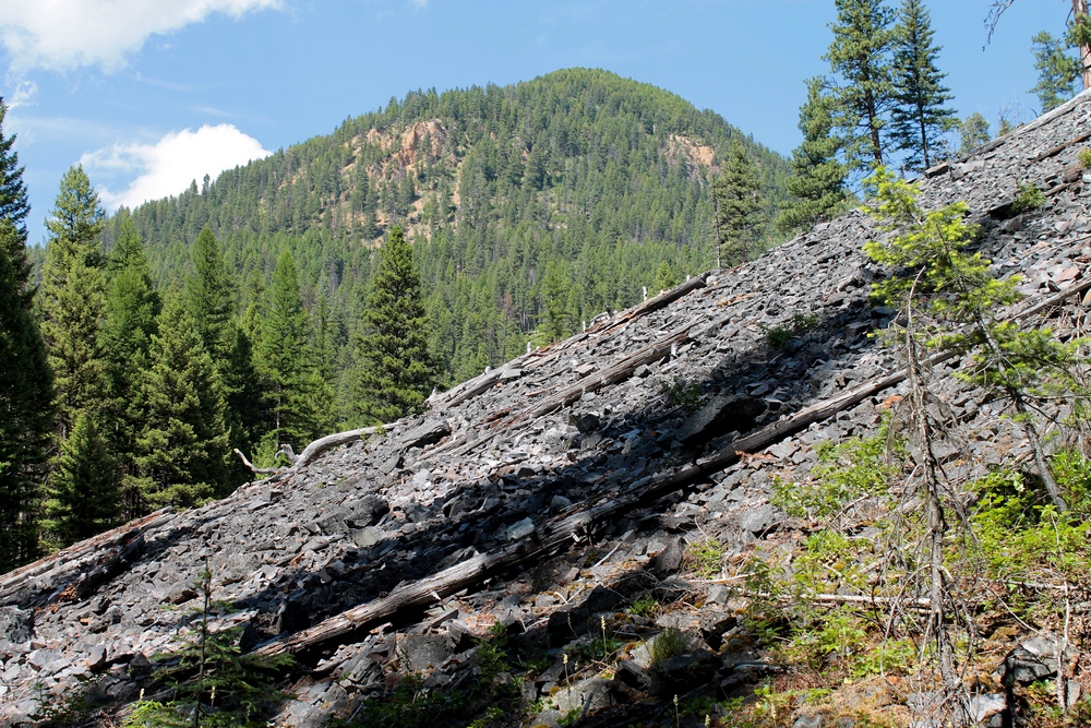
Last scree slide before the
bridge crossing Falls Creek. Our destination (unknown
to us at the time of this hike) can be seen above the 5000'
elevation in the distance on the side of that mountain which
offered a beautiful scenic view of the canyon falls and the
Ovando Valley. |
|
|
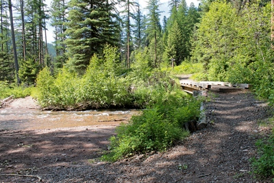
Monture Creek Trail bridge
crossing Falls Creek, which empties into Monture Creek
further downstream. |
|
 |
 |
 |
 |
|
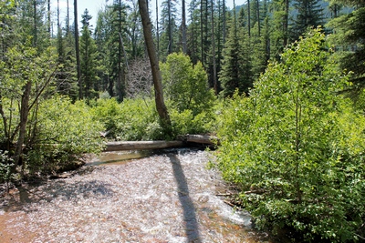
View of Falls Creek heading
downstream from the Monture Creek Trail wooden foot bridge. |
|
|
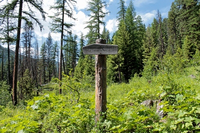
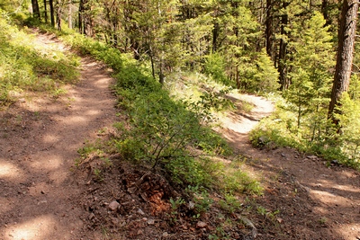
Sign of a fork in the
trail. The Monture Creek Trail splits just after the
Falls Creek bridge. |
|
|
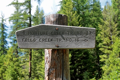
Old wooden sign after the
bridge. Monture Creek Trail (27) straight ahead and
the Falls Creek Trail (16) to the right. |
|
|
Looking south from the
Falls Creek Trail from about the 4800' elevation, a view of
the Ovando valley can be seen in the distance. |
|
 |
 |
 |
 |
|
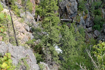
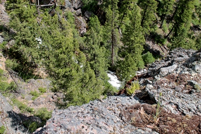
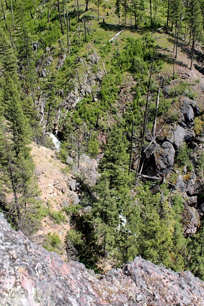
Obstructed view of the
Falls Creek falls cascading down the mountain from above the
5000' elevation. Distances are greater than they appear. |
|
|
View of the Falls Creek
falls cascading down the mountain from about the 5000'
elevation. Distances in the pictures appear closer
than reality. |
|
|
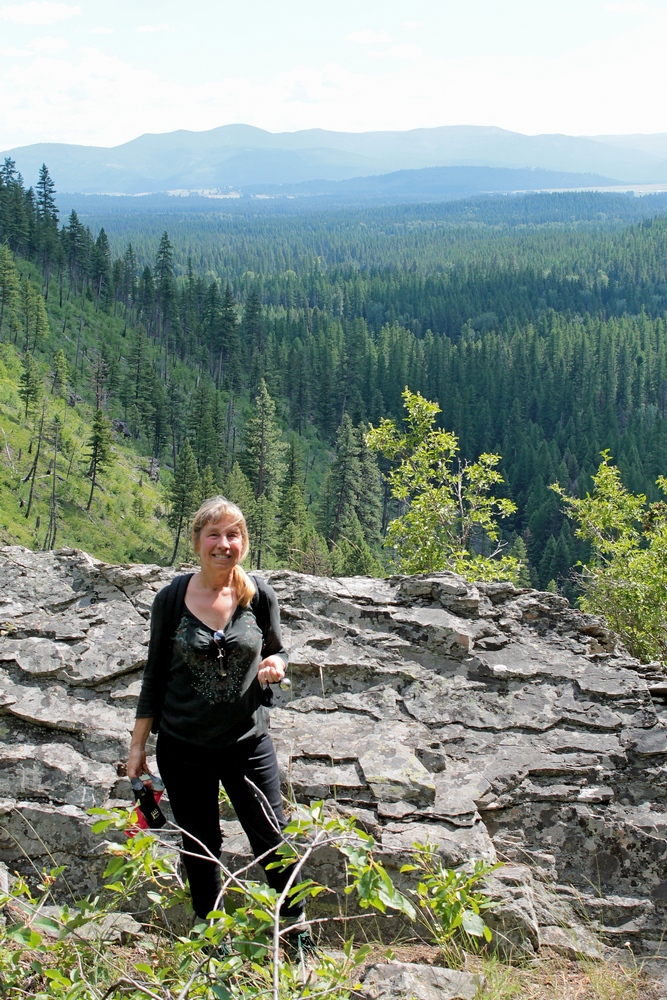
Looking south from an
overlook on the Falls Creek Trail adjacent to the falls from
about the 5000' elevation, a view of the Ovando valley can
be seen in the distance. |
|
|
Switchback in the Falls
Creek Trail around the 4600' elevation. |
|
 |
 |
 |
 |
|
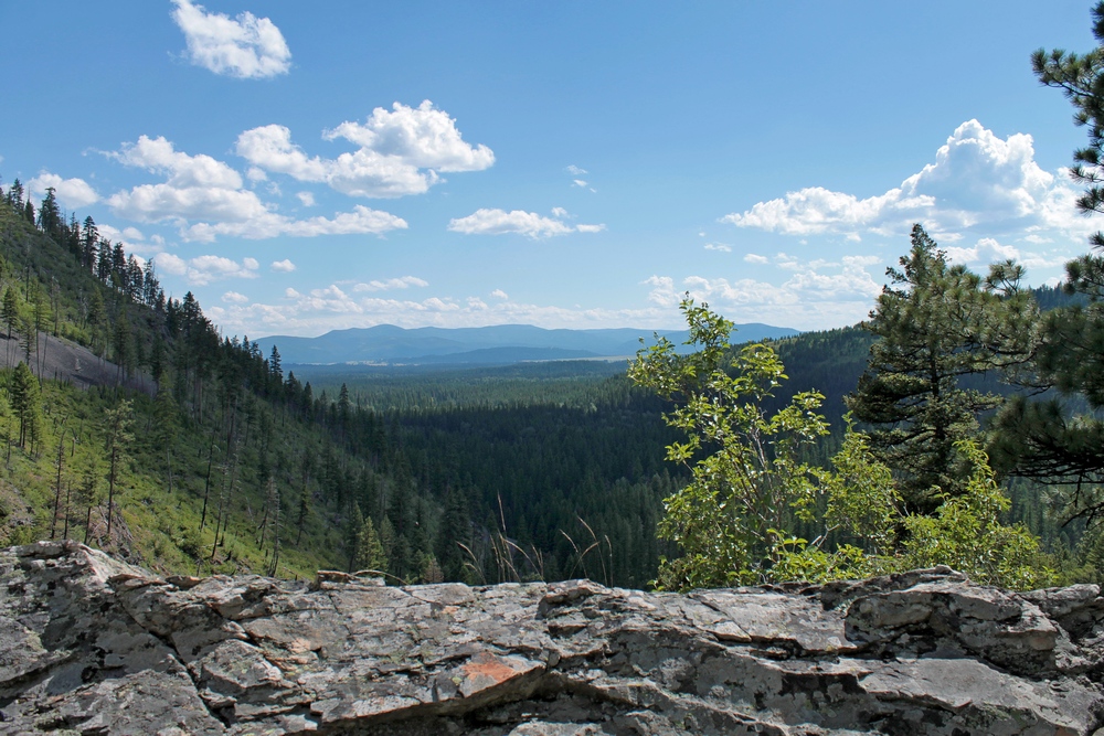
Scenic rocky overlook on
the Falls Creek Trail (16) looking south into the Ovando
valley from about 5000' above sea level. The canyon,
falls and view from the overlook are worth the moderately
strenuous hike. |
|
|
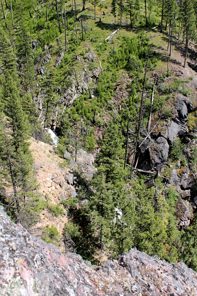
Looking into the rocky
canyon and across Falls Creek from the Falls Creek Trail
(16). The mountain across the creek continues up an
additional 1500' to an elevation of 6500' in the picture to
the right. |
|
|
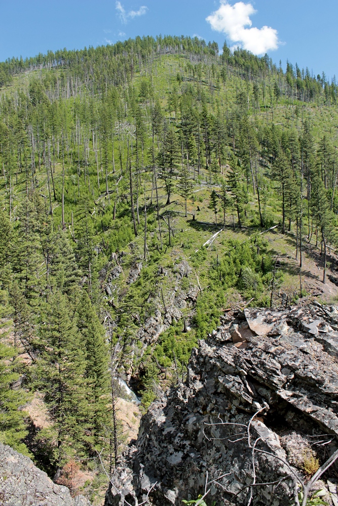
Looking across Falls Creek
from the Falls Creek Trail (16) and up the side of the 6500'
mountain to the east. |
|
|
Indian paintbrush seen on the
Falls Creek Canyon Trail (16) on 6/27/17 |
|